I thought that I’d interrupt my recent thematic approach (eg birdies — bugs —-buds — blossoms— wildlife ,etc over a week or so) to this blog to show a dozen photos of my experience at Burwash this afternoon.
I went up to Burwash to see if last night’s and today’s warm southerly winds would bring some new migrants to the abandoned Prison Farm.
Just before 4:00 PM I can across these (16) Painted Turtles sunning themselves under a clear sky.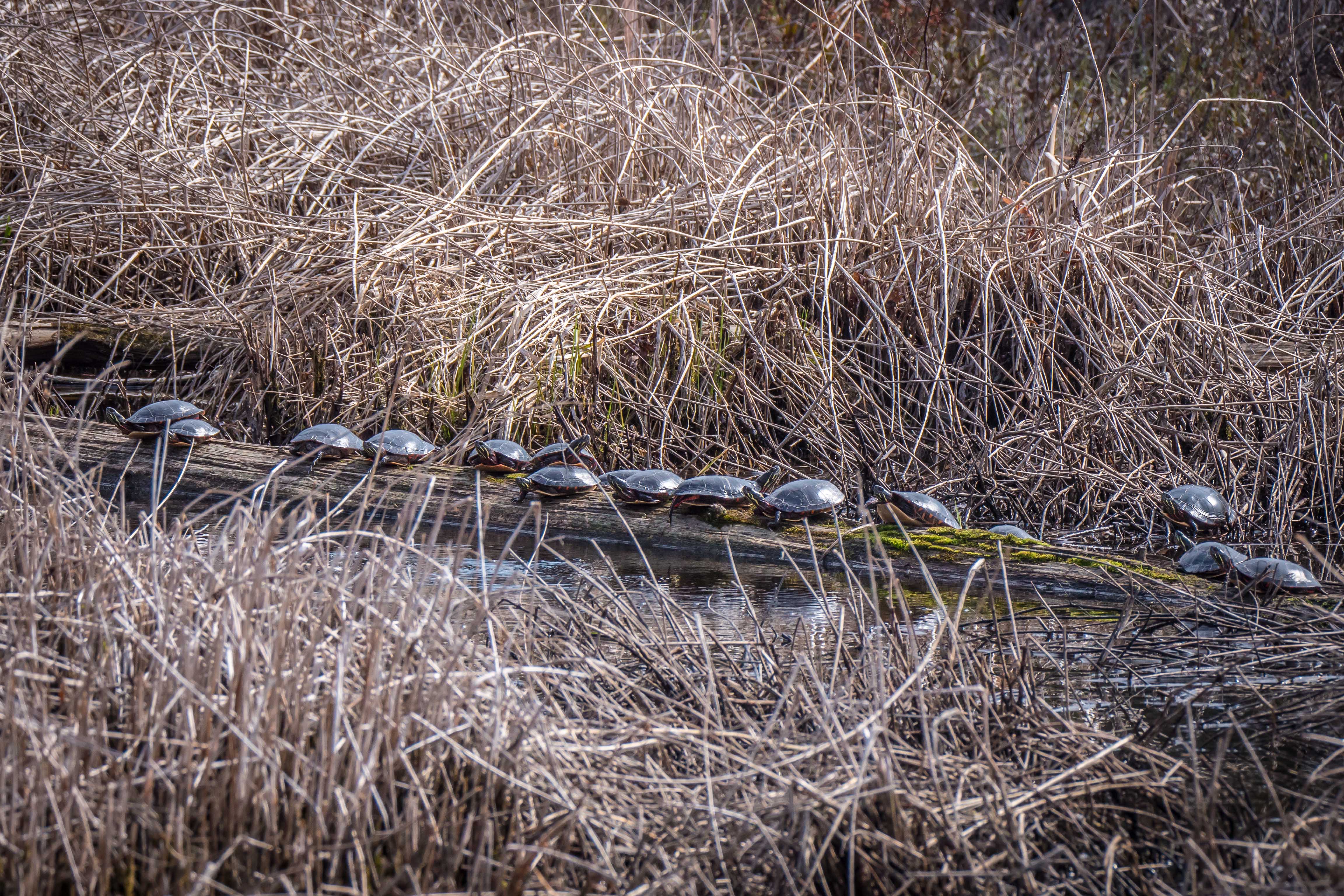
The sky was clouding up to the NW so I went up to the hill on which the old main prison was located and took this photo of the sky towards the West at 4:17:29 PM EDT……..
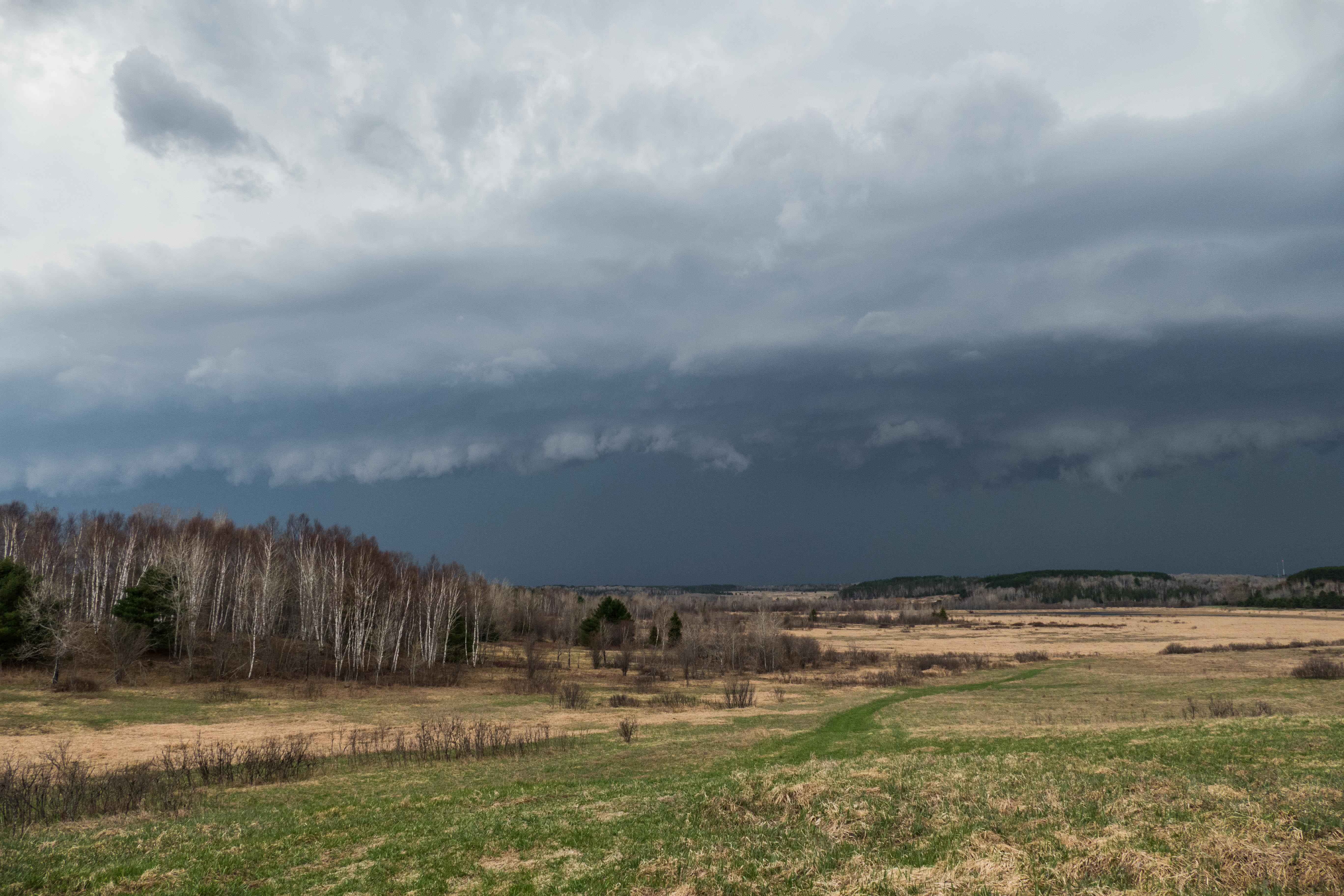
Looking NW at 4:19:09 ……..

Looking SW at 4:21:24………. a roll cloud ahead of precipitation …

4:22:04………

4:22:47………

4:23:27……..

Strong gusty wind was buffeting the car, lightning was striking close by and heavy rain started so I decided that discretion was the better part of valor and moved the car off of the hill towards the lee side where I could face the camera downwind, to the East.
4:25:09…….

4:25:31……

As the rain let up a bit I decided leave before being flooded out but got caught up in this hailstorm a few hundred feet away…
4:28:13

Which became a rainstorm again by 4:29:05 ….

The photo sequence above took about 12 minutes with the extreme precipitation taking about 5 minutes.
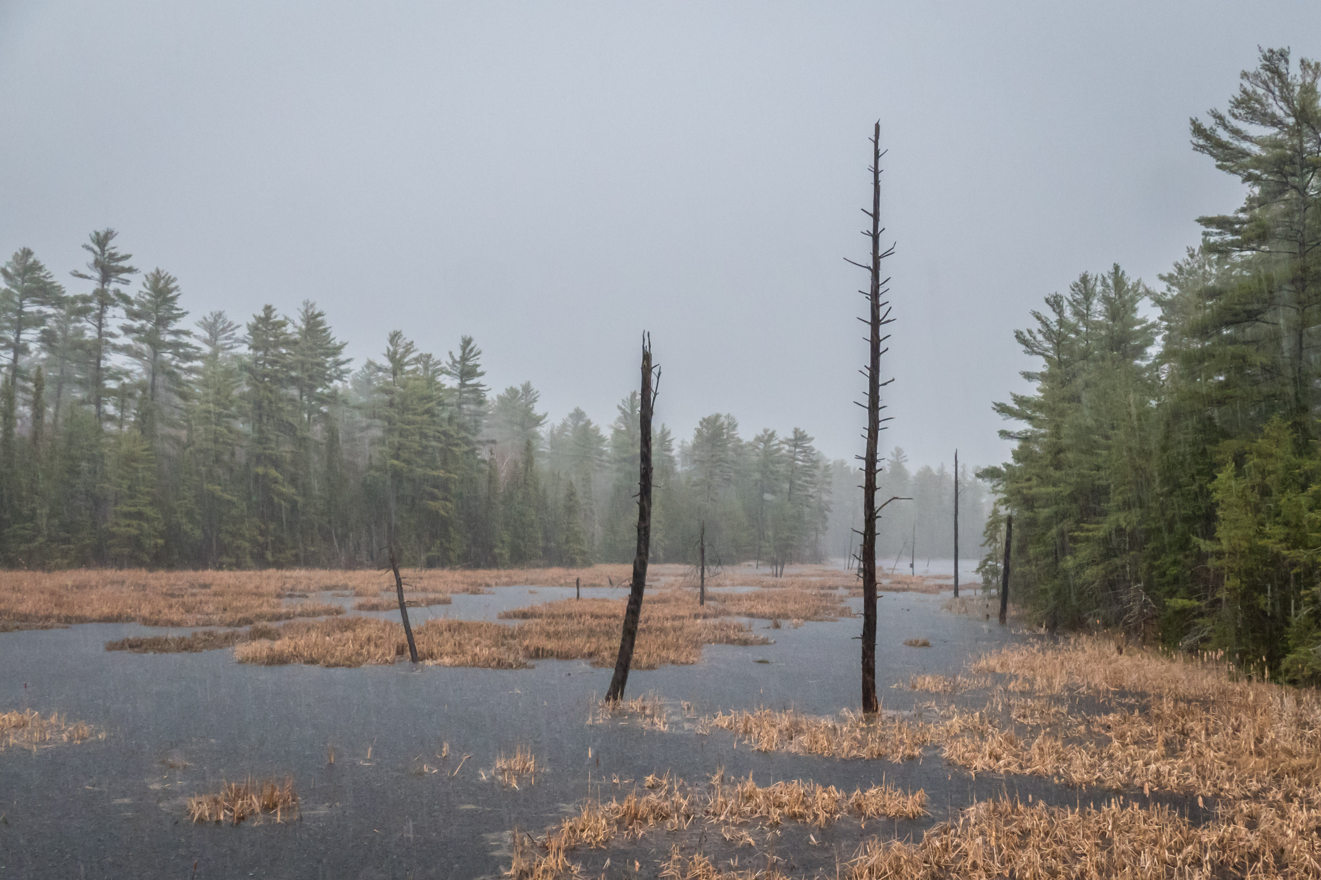
This is a nice peaceful scene taken on the way out at 4:30:52….

And, finally, this scene was photographed at 4:49:36 on the Burwash Road before getting to the Killarney Highway.
This is what Britt Radar showed at 4:40. Burwash is just to the West of Hwy 69, about 25 SSE of Sudbury.
A long string of heavy precipitation usually indicates a significant cold front where the cold air drives under the warm wet air causing heavy precip and donner and blitzen.

This is the weather map showing conditions about 2 1/2 hours after my event.
The cold front has rotated counter clockwise about the low centered up by Timmins. So we’ll have cooler temperatures tonight and for the next few days as we’ll be in a much cooler air mass.

The warmth was nice while it lasted.
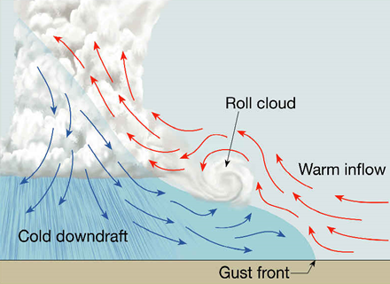
The Midwestern Regional Climate Center had a very good page on Thunderstorms which has this diagram showing the formation of the roll cloud shown in the first few photographs above:

THANK YOU SO MUCH FOR THIS … BREATHTAKING. xoxoxoxoxo
Yes, Scaaary too. I had to review my safety in so much lightning.
http://lightningsafety.com/nlsi_pls/vehicle_strike.html
TinTin was good. Sat quietly and watched the action. She didn’t like the hail hitting the car, though.
Thanks Tom for the info on the roll cloud as I have often wondered how they were formed! Great bit of weather captured! Brave Heart!!!
Yes, with your sailing background you know what to do when you see A SQUALL LINE WITH A ROLL CLOUD bearing down on you. See: http://www.yachtingworld.com/cruising/bluewater-sailing-techniques-part-3-coping-squalls-60334